Subject: North America
Period: 1781 (circa)
Publication: Lives of the British Admirals
Color: Black & White
Size:
14 x 13.1 inches
35.6 x 33.3 cm
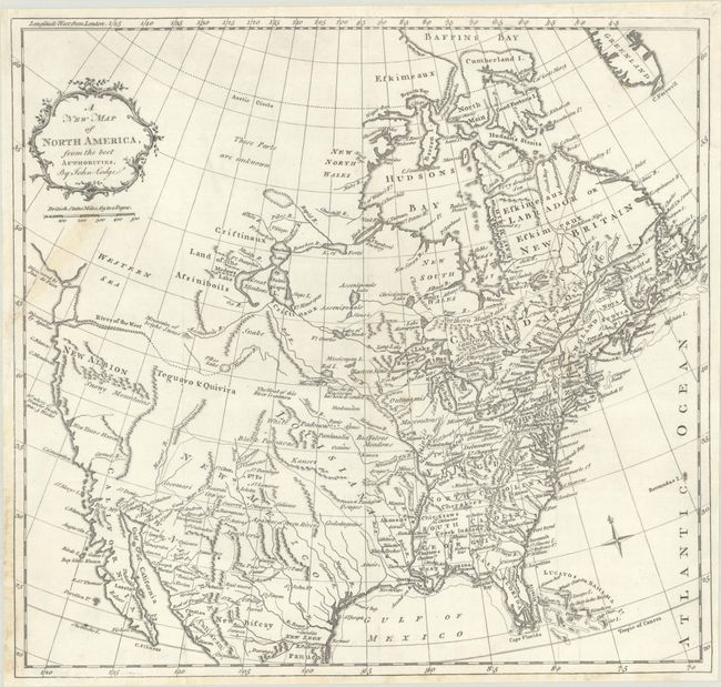
This scarce map of the early United States during the Revolutionary War is based very closely on Jonathan Carver's map of the same title from 1778. Virginia, the Carolinas and Georgia extend all the way to the Mississippi River, and Louisiana, New Mexico, Teguayo & Quivira, and New Albion take up the West. In the Pacific Northwest, the River of the West flows into an equally fictitious Pikes Lake. The Strait of Juan de Fuca appears to the north, leading into an amorphous Western Sea. The Sierra Nevadas are named the Snowy Mountains and bear east-west; a large mountain called the Mountain of Bright Stones is located roughly in the Canadian Rockies.
References: McGuirk #178.
Condition: B+
A crisp impression on a bright sheet with an archivally repaired 2" edge tear at left. The tear was previously repaired with old tape with some light staining visible on recto.