Subject: North America
Period: 1800 (circa)
Publication: Atlas Universel pour la Geographie de Guthrie
Color: Hand Color
Size:
8.9 x 7.3 inches
22.6 x 18.5 cm
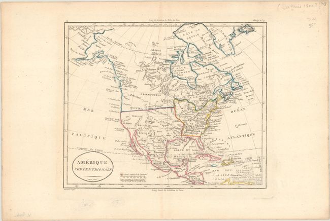
This small map of North America is an interesting document of a continent still in the process of being explored. The Mississippi River serves as the western boundary of the United States, with the western frontier under Spanish rule. Several states, cities, rivers, and Indian tribes are named. Out west, Santa Fe is the most prominent city to appear. Mythical Teguaio is located near the Colorado River, while Quivira is placed farther north than usual. Here, the R. de l'Ouest originates from the Oregon River. The northwest coast of the continent reflects Cook's recent discoveries.
References:
Condition: A
Contemporary outline color on a bright sheet with a coat of arms watermark, two tiny paper flaws in the image, and marginal soiling.