Catalog Archive
Auction 199, Lot 82

"Tableau Historique et Geographique de l'Amerique Septentrionale", Duval, Henri Louis Nicolas

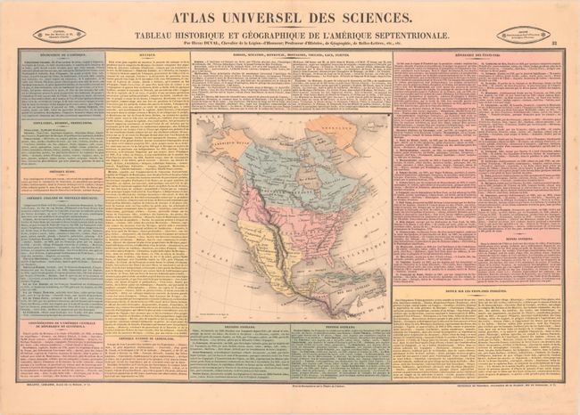
Subject: North America, Texas

Period: 1836 (circa)

Publication: Atlas Universel des Sciences

Color: Hand Color

Size:
8.3 x 8.6 inches
21.1 x 21.8 cm
Download High Resolution Image
(or just click on image to launch the Zoom viewer)

This finely engraved map is surrounded by color-coded text describing the United States, Canada, Russian America (Alaska), Greenland, Mexico, Central America and the Greater Antilles. It reflects U.S. interests in the Pacific Northwest as the boundary with Canada extends well into present-day British Colombia. The Southwest is controlled by Mexico including a named Texas without boundaries. The Great Basin in mostly void of detail but includes a pair of spurious rivers emptying into the Pacific Ocean. Engraved by Laguillermie. On a sheet of French text measuring 23.3 x 16.8".

References:

Condition: A

Contemporary color with a few faint dampstains confined to the blank margins.

Estimate: $150 - $180

Sold for: $120

Closed on 9/11/2024

Archived