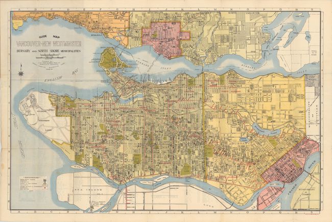
Subject: Vancouver, Canada
Period: 1935 (dated)
Publication:
Color: Printed Color
Size:
29.6 x 19.3 inches
75.2 x 49 cm
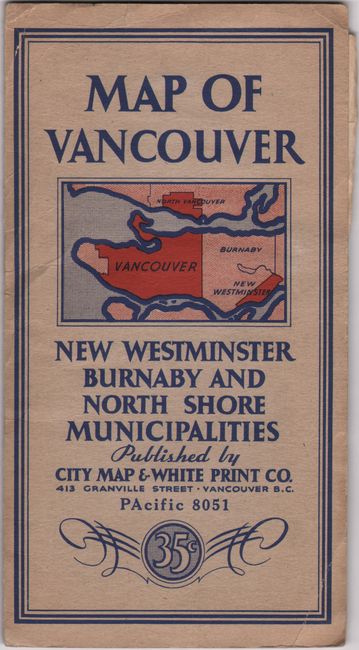
This handsome and informative pocket map of the Vancouver metropolitan region shows Vancouver, Burnaby, and New Westminster. It was published by City Map and White Print Co. Streets, neighborhoods, railways, parks, golf courses, University Endowment Lands, the Musqueam Indian Reserve, and more are laid out in stunning detail. A key locates postal block numbers, schools, fire halls, hospitals, and bus routes. Street index on verso. Lithography by Grant & Sons, Ltd. Folds into stiff paper covers (4.1 x 7.6") with an alternate title: Map of Vancouver New Westminster Burnaby and North Shore Municipalities.
References:
Condition: B+
Issued folding with a few short fold separations, minor wear along the folds, and a couple minor spots. Paper covers have lightly creased corners.