Subject: Atlases
Period: 1560 (published)
Publication:
Color: Black & White
Size:
8.2 x 12.3 inches
20.8 x 31.2 cm
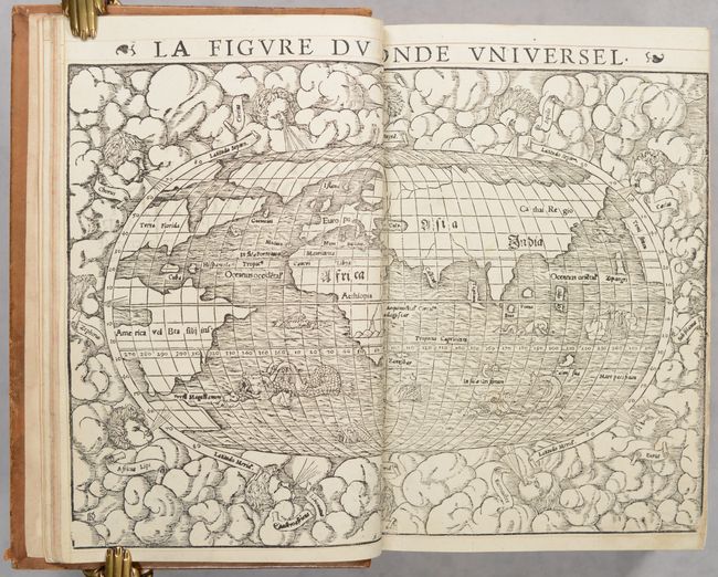
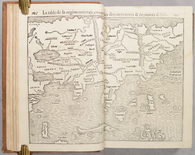
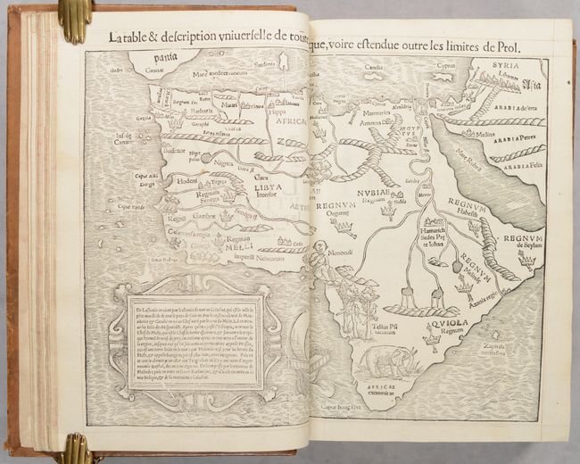
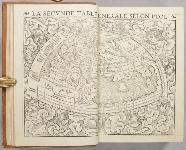
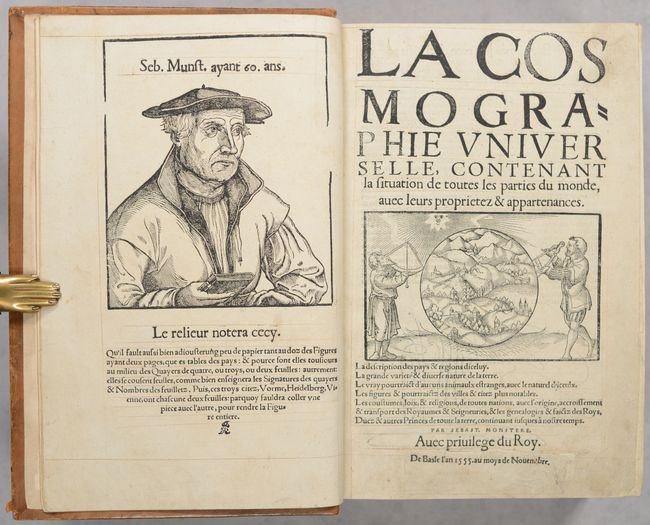
Sebastian Munster (1489 - 1552) was one of the three most renowned cartographers of the sixteenth century, along with Mercator and Ortelius. Munster's Geographia and Cosmographia Universalis were two of the most widely read and influential books of the period. His editions of Ptolemy's Geographia, published between 1540 and 1552, were illustrated with 48 woodcut maps, the standard 27 Ptolemaic maps supplemented by 21 new maps. These new maps included a separate map of each of the known continents and marked the development of regional cartography in Central Europe. The antique geography was a prelude to Munster's major work, the Cosmographia, which was published in nearly 30 editions in six languages between 1544 and 1578 and then was revised and reissued by Sebastian Petri from 1588 to 1628. The Cosmographia was a geographical as well as historical and ethnographic description of the world. It contained the maps from the Geographia plus additional regional maps and city views with nearly 500 illustrations which made it one of the most popular pictorial encyclopedias of the sixteen century.
Sebastian Munster probably had more influence in spreading geographical knowledge throughout Europe in the mid-sixteenth century than any of his contemporaries. His Cosmographia contained not only the latest maps and city views, but also included an encyclopedic amount of detail about the known, and unknown, world and its history. Henrich Petri, step-son of Sebastian Munster, was the publisher of Munster's Geographia and Cosmographia. After Henrich Petri's death in 1579, his son Sebastian Petri took over the publishing business and commissioned a completely new set of woodblocks for the Cosmographia. Over the years, the text was enlarged and new maps were added.
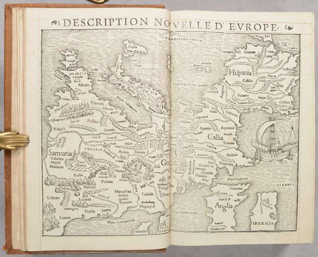
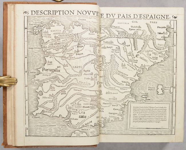
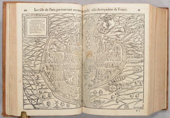
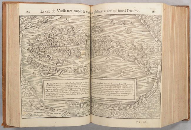
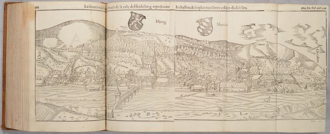
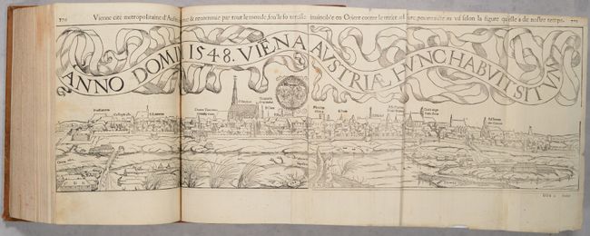
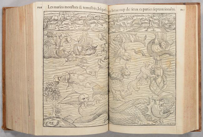
This French edition includes maps of the world, ancient world, the 4 continents, 8 regional maps, plus over 1000 woodcuts including 2 long folding views (of Vienna and Heidelberg), 37 double-page plans and views, and 66 smaller maps and views. Also included is the famous plate of Munster's Monsters, engravings of exotic animals, and a portrait of Sebastian Munster as the frontispiece.
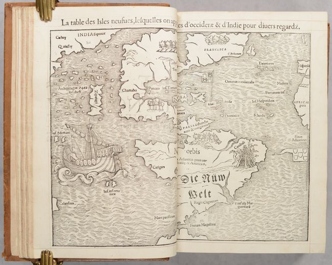
Of particular importance is Munster's map of the western hemisphere, La Table des Isles Neufues, lesquelles on Appelle Isles d'Occident & d'Indie, which is one of the most Important sixteenth century maps of the New World. The influence of Marco Polo's 13th century explorations in Asia are evident with the 7448 islands in the North Pacific and Zipangri (Japan) shown only a short distance off the western coast of North America. The North American continent is very oddly shaped without a California landmass and the eastern region is nearly bisected by a body of water, known as the Sea of Verrazzano. The Yucatan is still shown as an island, Cozumel is named nearby as Cozumela, and the lake at Temistitan is connected to the Gulf of Mexico. South America has a large bulge on the western coast, the Amazon River is very short, and cannibals inhabit the continent shown with the name Canibali next to a gruesome vignette with human limbs. The map is very decorative with Magellan's surviving ship Victoria appearing in the Pacific.
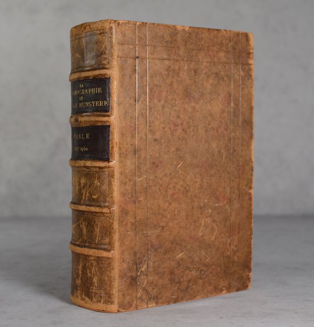
This example of the Cosmographia is complete. The title page has been erroneously updated with a cut-out of the publisher's imprint from the 1555 edition, which has been glued onto the page, however the colophon correctly states the publication date of 1560. Small folio. Frontispiece; title page; dedication page; [16] pp.; 14 double-page maps; 1337 pp. with over 1000 woodcuts and 105 maps and plans. The pages of this example have been ruled. Handsomely rebound in full mottled leather with embossed frame on covers; five raised bands with two black leather title labels on spine; and new endpapers.
References: Betz #3; Burden #12; Mickwitz & Miekkavaara #157; Shirley #76 & #92; Walter #8; Yeo #2.
Condition: A
Nearly all of the maps and views are clean and bright with occasional minor soiling. The world map has been mis-bound after map #4 (Spain & Portugal), and the double-page view of Florence is loose but original to the volume. Several of the double-page views were trimmed to the neatlines at right and left by the bookbinder, with partial loss of the neatline at right on the view of Venice, and partial loss of image at both sides on the views of Frankfurt and Wurzburg. The views of Venice and Speyer have a few tiny chips and tears into the image at right. There is a small dampstain along the fore-edge of pages 527-700 that remains confined to the margins on most of the engravings. There are some mis-folds of the two large folding views. There are occasional paper repairs along the edges of some pages. There is soiling on the title page, and the publisher imprint has been cut off the page and replaced with the imprint taken from a 1555 edition. There is scuffing and soiling on the covers, and the spine is heavily scuffed and worn. Overall this is a lovely and complete example that is rarely found in such excellent condition.