Subject: Exploration & Surveys
Period: 1625-26 (published)
Publication:
Color: Black & White
Size:
8.6 x 12.9 inches
21.8 x 32.8 cm
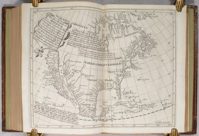
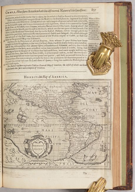
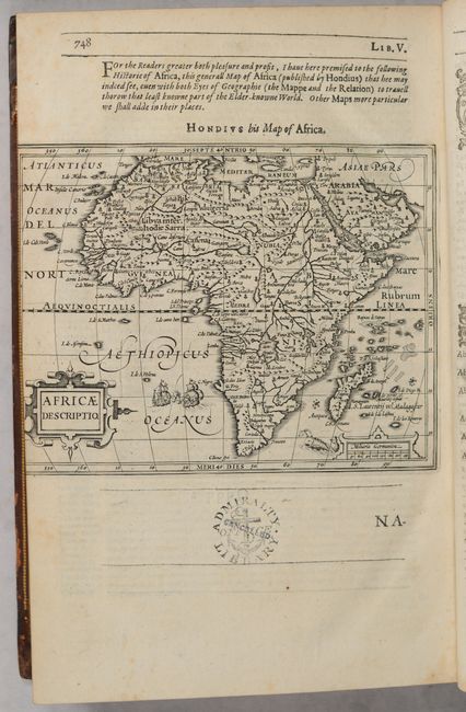
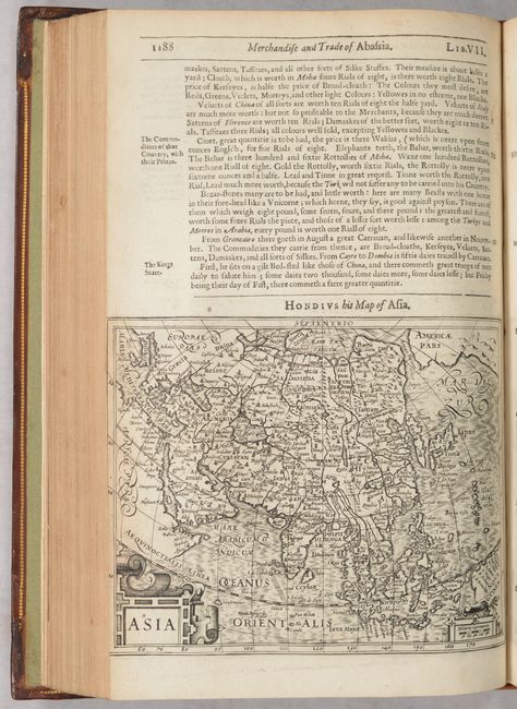
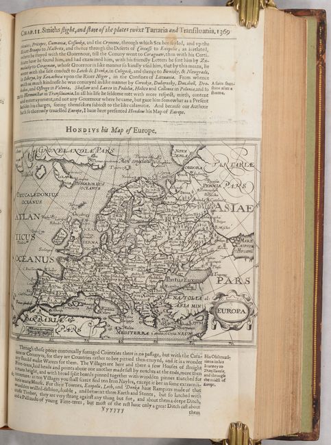
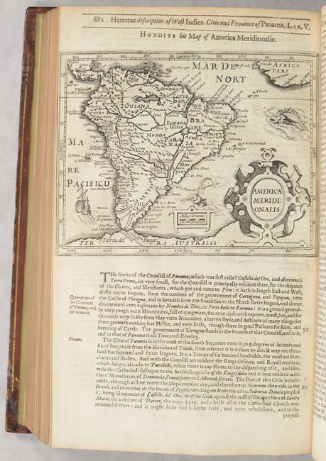
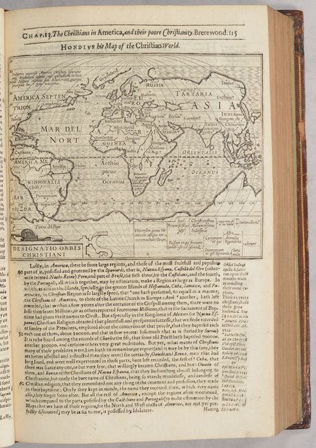
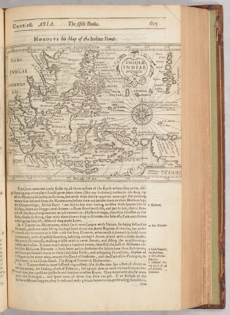
At the beginning of the 17th century, Samuel Purchas, an English cleric, set out to publish a compendium of voyages to foreign countries. To illustrate his work, Purchase obtained the rights to use Jodocus Hondius' copperplates from Atlas Minor. Fifty-eight of these half-page maps were included in Purchas His Pilgrimes, with English titles inserted above them. These half-page maps are comprised of two world maps, the North Pole, Iceland, Western Hemisphere, 3 related to North America, 2 of South America, 25 of Europe, 15 of Asia, and 8 of Africa. Purchas also included the double-page John Smith map of Virginia engraved by William Hole, and had five additional double-page maps engraved specifically for his work representing India, China, Greenland, North America, and Nova Scotia. In total, 58 half-page and 6 double-page maps were included in the first four volumes of Purchas His Pilgrimes.
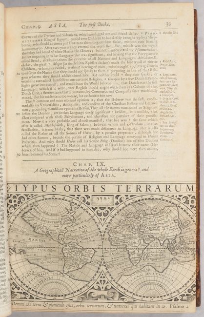
The fifth book is titled Purchas His Pilgrimage and was created as a separate work to recount the various religions around the world, although it is often bound together with the four-volume Purchas His Pilgrimes. This fifth volume was first published in 1613 without any maps. In 1626 it was republished and enlarged to include 23 half-page maps from Hondius' copperplates, as well as the newly engraved double-page map of China. All of the maps in the fifth book are duplicates from the first 4 books except for the small double-hemisphere world map by Hondius (Typus Orbis Terrarum).
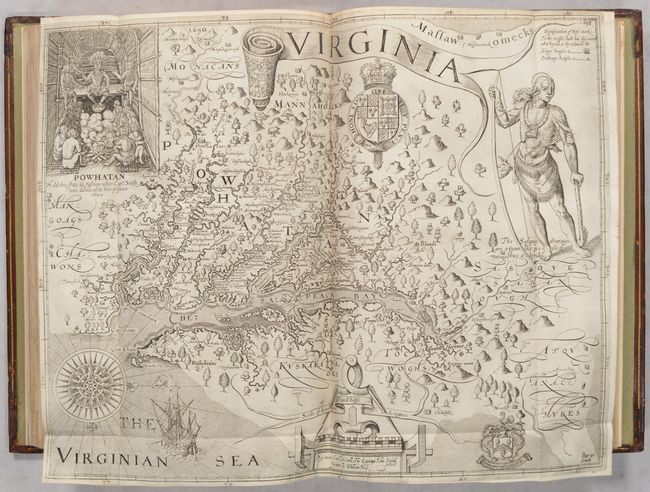
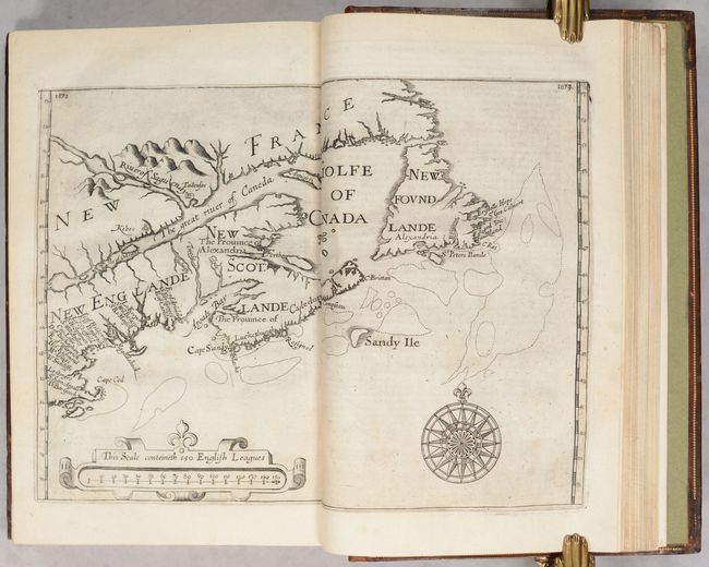
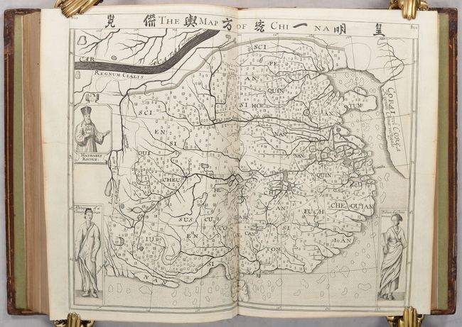
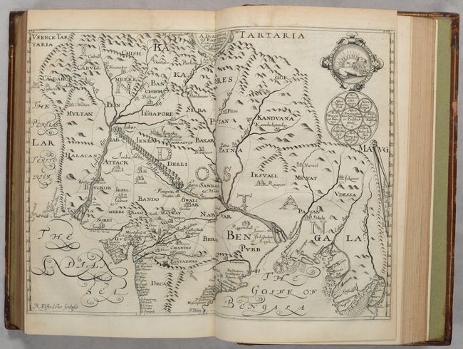
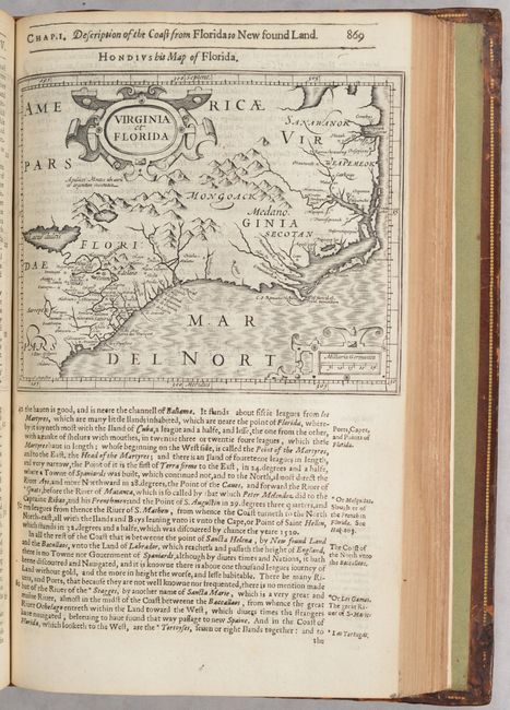
Of particular importance is John Smith's map of Virginia, which is considered one of the most important printed maps of America from the 17th century, and served as the prototype of the region for over half a century. The map is presented here in state 10, with the page numbers corrected to 1690 and 1691. Also of note is Henry Briggs' map of North America, The North Part of America Conteyning Newfoundland, New England, Virginia, Florida, New Spaine, and Nova Francia, which is the first English map to show California as an Island and helped to propagate the myth. The map was engraved by Reynold Elstracke, who also engraved the double-page map of India, A Description of East India Conteyning th'Empire of the Great Mogoll, which was based on the work of William Baffin and Sir Thomas Roe. William Alexandre's untitled double-page map of the Northeast is also included, which was issued to promote colonization in the region and is the first map to record place names such as New Scotlande and Cape Cod. Another of the double-page maps is that of China, which is an interesting combination of Eastern and Western cartography with Chinese characters included in the title and a portrait of the famous Jesuit father, Matteo Ricci. This map is included twice -- both in volumes 3 and 5.
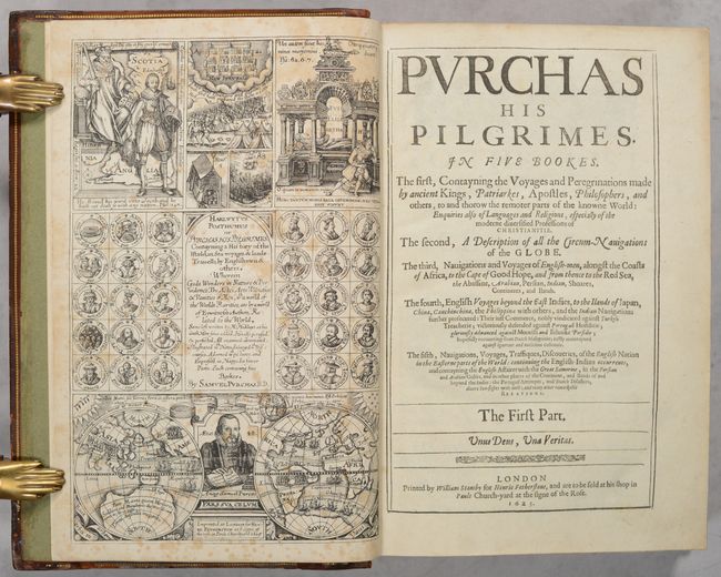
The engraved title page in volume I, which is missing in many examples, is in the second state, dated 1625. It features medallion portraits of famous explorers and biblical figures, biblical references, and a double-hemisphere world map flanking a portrait of Purchase himself.
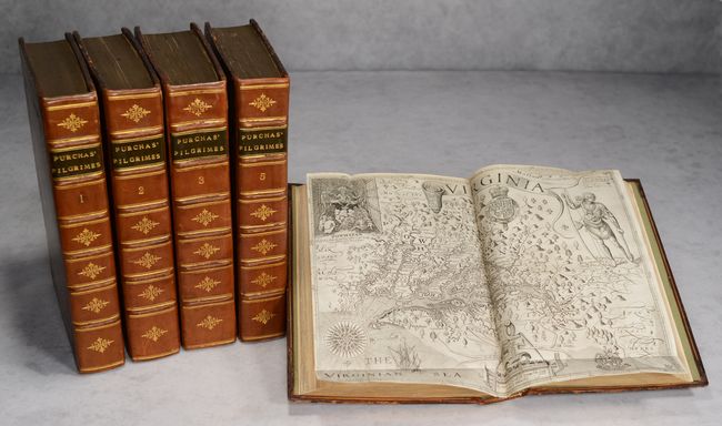
Five matching small folio volumes; 81 half-page and 7 double-page maps; engraved title page in volume I; letterpress title pages in all 5 volumes. Hardbound in full leather with 19th century boards with blind embossing and gilt dentelle; modern spine in seven compartments with raised bands, gilt tooling, and black leather title labels; a.e.g; new endpapers.
References: Burden #164, #208, #214; Church #401a; Shirley (BL Atlases) G.PUR-1a & 2a.
Condition: A
Pages in all volumes are bright with occasional soiling, foxing, and manuscript notations. Most of the map impressions are dark, occasionally resulting in offsetting on the opposing text page. Nine small maps are missing a portion of the right or left border due to being trimmed by the bookbinder (world, both maps of Africa, Iceland, Scandinavia, Germany, Cyprus, East Indies, and northwestern Africa). The Smith map of Virginia has a 1/4" tear at the fold intersection and an archivally repaired 1" tear at bottom. The large map of India has minor loss of the left border due to trimming by the bookbinder and has a repaired tear that enters 1.5" into the image at top. The colophon of Volume 2 has been archivally backed in tissue. There are minor tears or chips along the edges of a few text pages, some of which have been archivally repaired. The map of Africa in Volume I has a cancelled "Admiralty Office Library" stamp. The bindings are in very good condition with scuffing along the edges and a bit of soiling. The modern spines are in excellent condition.