Subject: Eastern United States & Canada
Period: 1794 (dated)
Publication:
Color: Hand Color
Size:
21.4 x 17.4 inches
54.4 x 44.2 cm
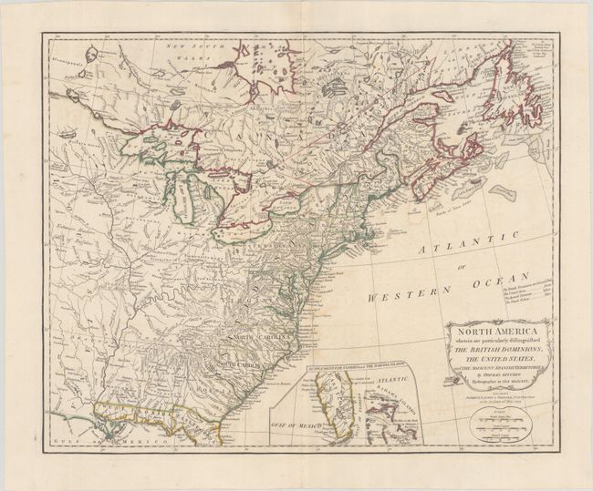
This scarce map uses color to denote the United States and the regions under British and Spanish rule. The French fisheries, which are meant to be colored in blue are not colored on this example, however a note indicates that they extend "from Cape St. John Northward to Cape Ray Southward." The new states are delineated, however Pennsylvania, Virginia, North Carolina, and Georgia do not have western boundaries. Florida, under Spanish rule, is divided into East and West. The United States extends to the Mississippi River, with Louisiana to the west, in which there are notes of "Extensive Meadows full of Buffaloes" and "Country full of Mines." The map is filled with information on early settlements, forts, Native American villages, and fishing banks, and includes an inset that shows the Florida peninsula and the Bahamas. This is the second state, published by Laurie & Whittle; the first state was published by Robert Sayer in 1789.
References: McCorkle #794.11.
Condition: B+
A crisp impression with contemporary outline color on a bright sheet with light offsetting.


