Subject: Western Canada & Alaska
Period: 1795 (published)
Publication: Collection de Cartes Geographiques, Vues, Marines, Plans et Portraits...
Color: Black & White
Size:
18 x 9.8 inches
45.7 x 24.9 cm
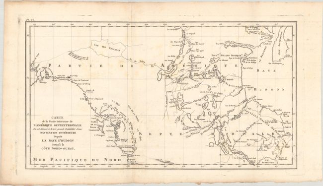
This scarce map appeared in the atlas volume to the French edition of Captain John Meares's travel account. It depicts a possible Northwest Passage spanning from Hudson Bay to Prince William Sound. Meares (ca. 1756-1809) is one of the more colorful figures in the early European exploration of the Northwest coast and Alaska. He claimed many of the discoveries of others as his own and rekindled the idea of the Sea of the West and a Northwest Passage. His mythical inland sea appears here stretching from the Strait of Juan de Fuca northwards to just north of the Queen Charlotte Islands. A note indicates that the American sloop Lady Washington had explored this sea in 1789. This was a complete fabrication on the part of Meares; nevertheless it gave new credence to the idea and appears on several later maps as well. Meares played a part in the Nootka Crisis, an international incident that almost pushed Britain and Spain into war against each other. A note in French text west of Slave Lake indicates the most considerable waterfalls in the known world, after which the course of the river becomes conjectural.
References: Kershaw #1173; McGuirk #217; Shirley (BL Atlases) G.MEAR-2a #2.
Condition: B+
A nice impression issued folding with light scattered foxing.


