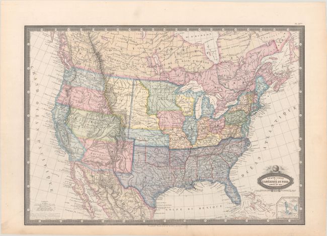
Subject: United States, Civil War
Period: 1860 (dated)
Publication: Atlas Spheroidal & Universel de Geographie
Color: Hand Color
Size:
19.8 x 14.1 inches
50.3 x 35.8 cm
This map depicts the state and territorial boundaries of the United States at the beginning of the Civil War. Although the map is dated 1860 in the title cartouche, it was published in 1862. The Southern States are marked in purple, and a note at bottom left explains that these states separated from the Union in 1861. Interestingly, Virginia is not shown as part of the Confederate States. Also of interest is the appearance of Deseret in the territory of Utah. Several other large territories are shown, including Nebraska, Kansas, New Mexico, and Washington, with the locations of a number of Native American tribes noted. A small inset depicts the islands of Saint Pierre and Miquelon. The map shows the burgeoning railroad system in the east, with only one route extending west of the Mississippi River to Jefferson City, Missouri.
Garnier's Atlas Spheroidal & Universel de Geographie is quite rare and sought-after for its elegant hand coloring, precise engraving, and decorative maps.
References: Phillips (Atlases) #836-50bis.
Condition: B+
A nice impression with full contemporary color, very light foxing, and a bit of toning along the edges of the sheet.


