Catalog Archive
Auction 201, Lot 127

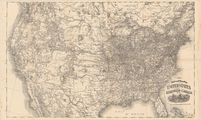
"New Railroad Map of the United States and Dominion of Canada"
Subject: United States

Period: 1876 (dated)

Publication:

Color: Black & White

Size:
26.8 x 16.3 inches
68.1 x 41.4 cm
Download High Resolution Image
(or just click on image to launch the Zoom viewer)

A highly detailed lithograph published by J.W. Goodspeed. The map presents a dense network of railroads east of the Mississippi River with several transcontinental routes extending to the Pacific Ocean. In addition to railroads, there is good detail of cities and towns, numerous forts, rivers and mountains. The map extends to include railroads in eastern Canada and northern Mexico.

References:

Condition: B+

Issued folding and now flattened and backed with tissue to reinforce and repair a number of fold separations mostly along the horizontal fold. There is scattered foxing and minor staining in the right margin.

Estimate: $160 - $190

Sold for: $150

Closed on 11/20/2024

Archived