Subject: Eastern United States
Period: 1859 (dated)
Publication:
Color: Hand Color
Size:
34.5 x 31 inches
87.6 x 78.7 cm
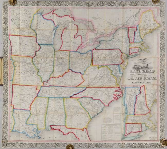
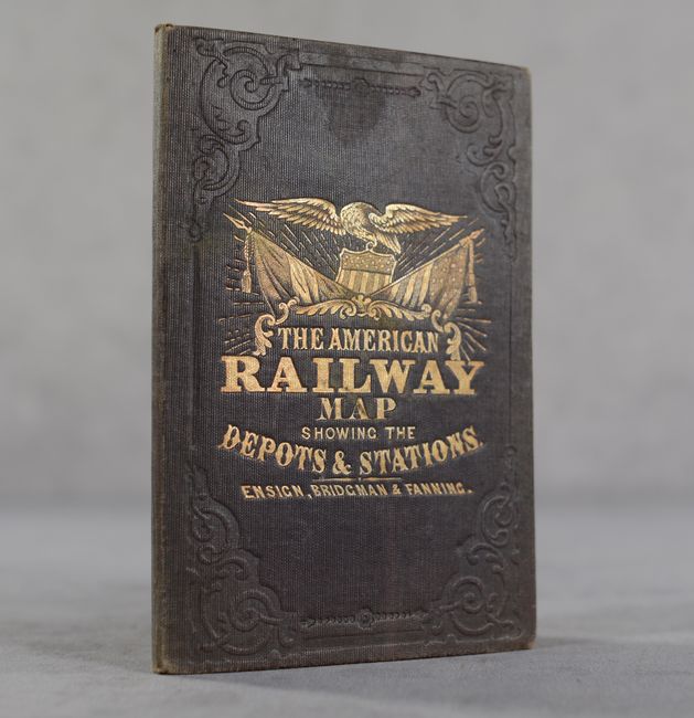
This pocket map shows the United States west to the Mississippi River and a little beyond to include a small portion of Texas, Indian Territory, and Kansas Territory. It presents the evolving railroad network with both proposed and existing lines depicted, extending as far west as St. Joseph, Missouri. Many of the existing lines are numbered to a table at bottom that names the railroads by state. Includes an inset map of New England at lower right. A publisher's notice states that they "intend printing small editions at a time in order that additions may be made as Railroads are completed." These types of maps were designed for the burgeoning number of travelers and new immigrants. The maps were printed on thin banknote paper and folded so they could be carried easily for quick reference while traveling. Folds into brown cloth boards with gilt title and U.S. seal on the front cover.
References:
Condition: B
Issued folding on a bright sheet of banknote-style paper with minor foxing and numerous short fold separations that have been mostly closed on verso with old tape. Covers have light wear.