Subject: Southern United States
Period: 1812 (circa)
Publication: Brookes's General Gazetteer Improved...
Color: Black & White
Size:
9.5 x 7.8 inches
24.1 x 19.8 cm
Mathew Carey was a seminal figure in early American publishing; establishing the first publishing firm to specialize in cartography and issuing the first atlas devoted exclusively to American maps. He set up an elaborate cottage system of craftsmen for compiling, engraving, printing, and coloring maps. This practice was emulated by later American cartographic publishers such as John Melish and Henry S. Tanner. The American Atlas concept was also adopted by other publishers in both the United States and Europe.
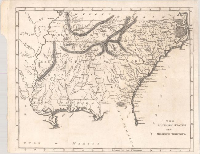
This uncommon map covers current-day Tennessee, North Carolina, South Carolina, Georgia, Alabama, Mississippi, and northern Florida. The oversized Mississippi Territory includes today's Alabama, thus stretching to the Mississippi River. Political boundaries are circa 1812, as the Mobile district along the Gulf of Mexico is not yet annexed to the Mississippi Territory. The Florida panhandle is designated as West Florida, while the area west of the Mississippi River is Louisiana.
References:
Condition: B+
Issued folding with faint offsetting and a 0.75" archivally repaired fold separation at bottom.