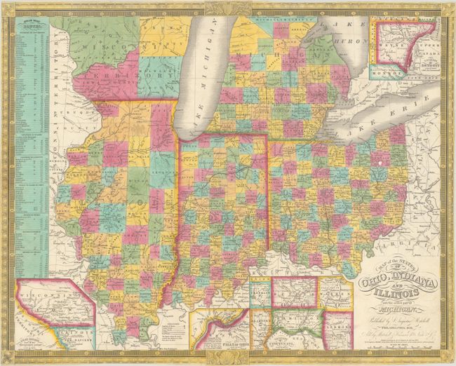
Subject: Upper Midwestern United States
Period: 1836 (dated)
Publication:
Color: Hand Color
Size:
22.3 x 17.8 inches
56.6 x 45.2 cm
This early Mitchell map illustrates the growing Midwest with counties delineated in hand color, towns and settlements, wagon roads, railroads, and canals. The map was issued one year before Michigan became a state (1837) and much of lower Michigan had been surveyed by this time. The map predates Iowa Territory (1838), with Wisconsin Territory occupying both sides of the Mississippi River. The map features four insets including "Vicinity of Detroit", "Vicinity of Cincinnati", "Falls of Ohio", and "Lead Region East of the Mississippi River." This mineral-rich region of southwestern Wisconsin brought thousands of miners and economic activity to the region. Various steamboat routes flank the map at left. Decorated by an elaborate keyboard and floral border and fancy titling. This map was first issued by Anthony Finley in 1825 and updated here by Mitchell. Copyright dated 1834 and sold by Mitchell & Hinman. No covers present.
References:
Condition: A
A very clean and colorful example with one tiny split at a fold junction that has been closed on verso with archival materials. Issued folding and now flat. No covers present.


