Subject: Los Angeles, California
Period: 1930 (dated)
Publication:
Color: Hand Color
Size:
25.6 x 19.8 inches
65 x 50.3 cm
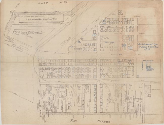
This is a detailed map of part of Terminal Island in East San Pedro, Los Angeles, that prior to World War II was home to a vibrant Japanese community closely tied to the fishing and canning industries. Various companies are located along with the streets, which have appropriate names including Tuna, Albacore, and Cannery streets. Community buildings are identified including the Japanese Fisherman Association Hall, the Japanese Christian Mission and Shinto Temple. Ominously, a collection of houses at the top of the map are marked "W" identified in the legend as "White Family." At the beginning of the War the Japanese community in Terminal Island was among the first sent to internment camps. Residents had 48 hours to pack their belongings. The houses and other community buildings, including the Shinto temple, subsequently were razed. On their return, the prior residents found their community had vanished. Today "Tuna Street" still exists but little else of the community remains. We found no past sales records or institutional examples on OCLC for this map.
References:
Condition: B
Issued folding with numerous fold separations closed on verso with archival tape. There are also some old repairs (that appear to be archival) along the horizontal fold on recto. Glued to a sheet on verso at top right with some staining visible on recto.


