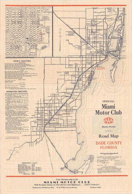
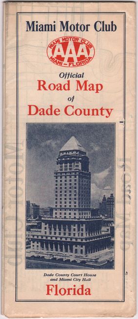
Subject: Miami, Florida
Period: 1931 (dated)
Publication:
Color: Printed Color
Size:
17.8 x 24.9 inches
45.2 x 63.2 cm
This early road map by Charles Hannock extends from Key Largo north to Miami Beach and the Dade/Broward county line. It shows streets, a few highways, several railroads including the Florida East Coast Railroad, and the Miami Canal. An inset at top left shows the downtown area. The verso is filled with promotional text while the rear cover lists parks, including a “Colored Park” with baseball and football fields, one tennis court and a boxing area. The map was “Adopted by the County Commissioners of Dade County as the Official Road Map of Dade County, Florida December 1931.” Unrecorded in OCLC, which shows a single location for a 1921 edition.
References:
Condition: B+
Issued folding on a bright sheet with some crayon markings in the image and a few small holes in blank areas adjacent to the title. There is light show through from text on verso.