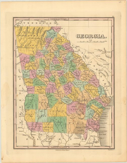
Subject: Georgia
Period: 1828 (circa)
Publication: A New General Atlas...
Color: Hand Color
Size:
8.8 x 11.4 inches
22.4 x 29 cm
Attractive map of the state that details the roads, towns and settlements of the day. Numerous counties are delineated via hand coloring and engraved lines. The northwest corner is unorganized and labeled Cherokee Indians with three missionary stations identified. County configuration is around 1828, with the newly developed counties of Campbell and Randolph. Engraved by Young & Delleker. Finley published his atlases annually between 1824-1834, with one final edition appearing in 1836 (Ristow states his last atlas was 1834).
References: Phillips (Atlases) #752-21; Ristow, pp. 268-70.
Condition: B+
A crisp impression with contemporary color, a couple of minor spots, and a dampstain in Appling County.


