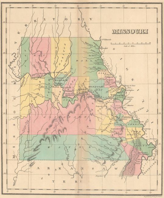
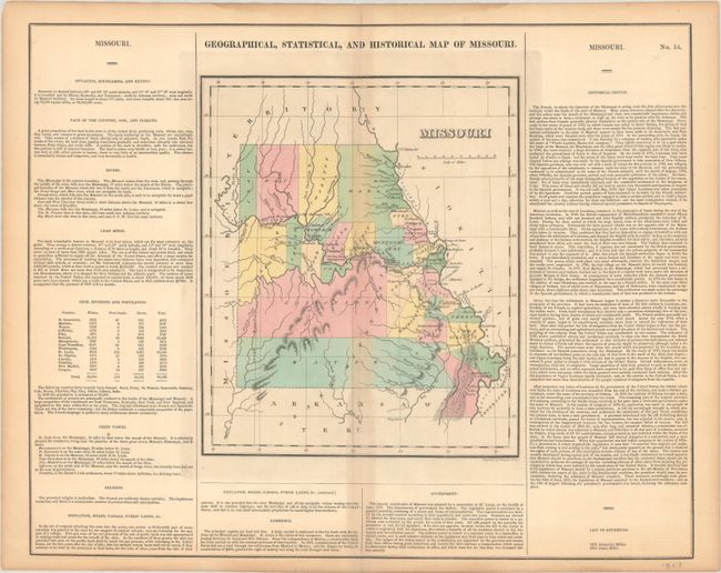
Subject: Missouri
Period: 1827 (circa)
Publication: A Complete Historical, Chronological, and Geographical American Atlas
Color: Hand Color
Size:
9.9 x 11.9 inches
25.1 x 30.2 cm
This early map of Missouri presents 28 counties with development confined to the areas around the Mississippi and Missouri rivers. In the western portion of the state the Osage Boundary Line is shown, in reference to the Treaty of Fort Clark (1808) in which the Osage Nation ceded everything east of this line and north of the Arkansas River to the United States. The map is surrounded by text describing the boundaries, climate, rivers, lead mines, chief towns, religion, education, commerce, government, and history of the state. A table at left breaks down the population of each counties whites, free blacks (376), and slaves, with a total state population of 66,586. A list of governors at bottom right reveals just two names. On a full folio sheet (22.3 x 17.6") and engraved by Young & Delleker.
References:
Condition: B
Contemporary color with light staining along the centerfold and top and bottom blank margins.