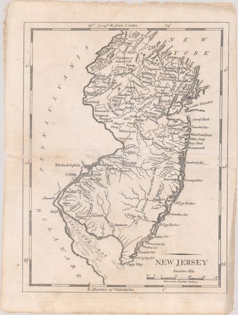
Subject: New Jersey
Period: 1796 (published)
Publication: American Pocket Atlas
Color: Black & White
Size:
5.8 x 7.6 inches
14.7 x 19.3 cm
Mathew Carey was a seminal figure in early American publishing; establishing the first publishing firm to specialize in cartography and issuing the first atlas devoted exclusively to American maps. He set up an elaborate cottage system of craftsmen for compiling, engraving, printing, and coloring maps. This practice was emulated by later American cartographic publishers such as John Melish and Henry S. Tanner. The American Atlas concept was also adopted by other publishers in both the United States and Europe.
This early map of the state presents towns and settlements, rivers and topography, and coastal features. The area depicted extends to included Manhattan, the city of Philadelphia, and the Delaware Bay. The distance scale is in "American Miles." Engraved by Amos Dolittle. This is the first state of the map with no road network.
References: Wheat & Brun #416.
Condition: B+
On watermarked paper with light soiling, a couple of tiny holes along the centerfold, and a 1" archivally repaired centerfold separation at left.