Subject: Niagara Falls, New York
Period: 1835 (circa)
Publication: H.R. Doc. 214, 24th Congress, 1st Session
Color: Black & White
Size:
29.3 x 41.6 inches
74.4 x 105.7 cm
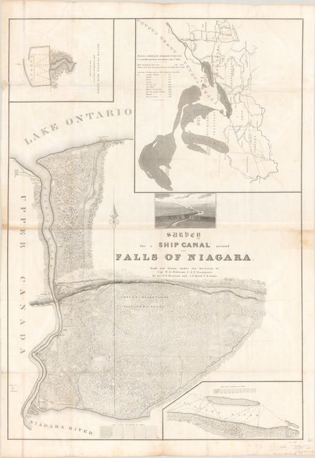
This large survey chart was prepared by Lts. T. F. Drayton and J. C. Reed, under the direction of Capt. W. G. Williams. The chart shows a proposal for building a canal around Niagara Falls to allow shipping from Lake Erie to Lake Ontario. The topography is precisely presented with insets of a harbor at Four Mile Creek, a map of the Great Lakes taken from Tanner's map of the U.S., a chart of the Niagara River near the falls, and a bird's-eye view of the region showing the elevation change the canal would traverse. Though the canal was never built, this map is a great example of American engineering design and mapmaking in the early part of the nineteenth century. Printed on 2 joined sheets, as issued.
References: Claussen & Friis #129.
Condition: B
Issued folding with light, scattered dampstains, light toning along the joint at left, a 2" archivally repaired edge tear at top left, and a couple short separations at fold intersections.


