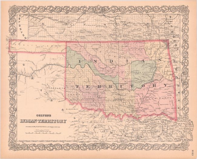
Subject: Oklahoma
Period: 1876 (dated)
Publication:
Color: Hand Color
Size:
16.5 x 12.9 inches
41.9 x 32.8 cm
This detailed map reflects the status of lands allocated to various tribes. In 1817 the U.S. government began to relocate the principal eastern Indian tribes from their traditional home lands to Indian Territory where the Five Civilized Tribes formed the nucleus of an organized government. By 1876 there were more that twenty-five tribes settled on lands once promised to the original five. In addition to Indian Territory, this map includes the Public Lands in the panhandle that ultimately became part of the State of Oklahoma. Surrounded by Colton's signature strapwork border. Unrelated text on verso.
References:
Condition: A
Contemporary color with faint toning along the sheet edges.