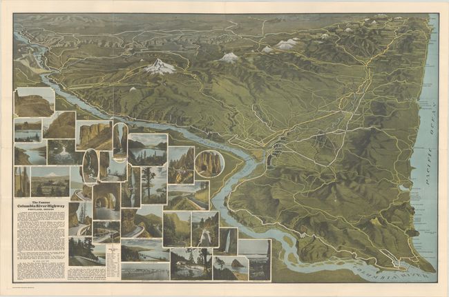
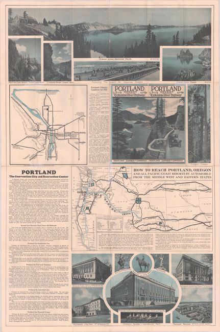
An attractive view of eastern Oregon drawn by Fred Routledge for the Portland Chamber of Commerce, with north oriented to the bottom of the sheet. It extends from Biggs and The Dalles west to Portland and Astoria, following the course of the Columbia River. The view presents topography with a three-dimensional aspect and locates snow-capped Mt. Hood, Mt. Jefferson, and the Three Sisters. The lower left portion of the image is filled with photographic illustrations highlighting the region's natural attractions that can be viewed from the Columbia River Highway, which opened up to the public in 1922. Circa date comes from text referring to a new Cloud Cap Inn, to begin construction in "the coming summer of 1926." The verso contains related text and illustrations including a large view of Crater Lake National Park and a road map, "How to Reach Portland, Oregon and All Pacific Coast Resorts by Automobile from the Middle West and Eastern States." Self-folding in pictorial wrappers (4.0 x 8.4").
For an excellent article on Routledge and his work, click here.
References: Rumsey #8862.
Condition: B+
Issued folding with several short separations along the folds that have been closed on verso with archival tape, and a couple of small areas of loss in the Mitchell Point Tunnel and Devil's Punch bowl vignettes at left.