Catalog Archive
Auction 201, Lot 313

"Mexique", Tardieu, Jean Baptiste Pierre
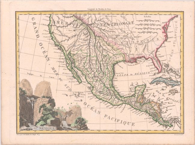
Subject: United States & Mexico

Period: 1812 (circa)

Publication: Atlas Complet Du Precis De La Geographie Universelle...

Color: Hand Color

Size:
12 x 8.8 inches
30.5 x 22.4 cm
Download High Resolution Image
(or just click on image to launch the Zoom viewer)

This very nicely engraved, copper plate map features the Province de Texas with only a few towns identified (S. Jose, Arcaquisas, and Chichi). Political boundaries in Mexico are delineated south of the Gila River, and there is good detail throughout the map. The lakes Timpanogos and Teguyo are located with a conjectural river connecting Teguyo to San Francisco Bay. Florida is still divided into Occidentale and Orientale. The title is surrounded by a large vignette of falls and cliffs. Lettering by Giraldon.

References: Day (TX), p. 9.

Condition: A

A crisp impression on a clean sheet.

Estimate: $140 - $170

Sold for: $70

Closed on 11/20/2024

Archived