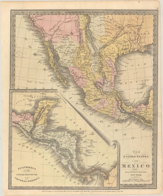
Subject: Southwestern United States & Mexico, Texas
Period: 1832 (dated)
Publication: A New Universal Atlas
Color: Hand Color
Size:
10.4 x 12.6 inches
26.4 x 32 cm
This important map shows Mexico three years before Texas became independent. The small Texas configuration is prominently shown, including the towns of San Antonio and San Felippe de Austin. In 1830, Mexico attempted to stop the flood of Americans settling in Texas by blocking further emigration. In June of 1832, a small battle occurred between the Texans and Mexicans at the Battle of Velasco, just after this map was published. This battle occurred as Texans were transporting cannons to assist some unhappy settlers in Anuahuac, and as they passed Fort Velasco they were fired upon by the Mexican garrison stationed there. The battle continued until the garrison ran out of ammunition and the Texans continued on their journey to Anahuac. An inset map of Central America at lower left is titled "Guatemala or the United Provinces of Central America."
References:
Condition: B+
Full contemporary color on slightly wavy paper. A short edge tear at bottom has been closed on verso with archival tape.


