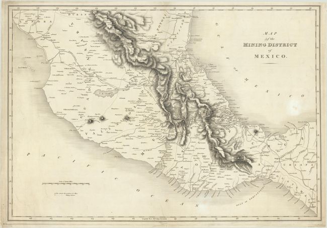
Subject: Central Mexico
Period: 1824 (circa)
Publication: Selections from the Works of the Baron de Humboldt...
Color: Black & White
Size:
23 x 15.8 inches
58.4 x 40.1 cm
This map was published in Humboldt's Selections from the Works of the Baron de Humboldt Relating to the Climate, Inhabitants, Productions, and Mines of Mexico. Covering central Mexico, the map presents the rugged topography of the region through fine hachure and locates numerous mines and mining stations mostly to the north and west of Mexico City. The map further locates towns and settlements, roads, rivers and lakes. This was the only map published in the work.
Alexander von Humboldt was a world-famous geologist, geographer, naturalist, and explorer. He spent 5 years exploring Latin America along with his partner Aime Bonpland. He was one of the first to document the area from a scientific point of view and the first to complete a profile view of an entire country.
References: Sabin #33740.
Condition: B+
A crisp impression with an "1818" watermark, light soiling, and professionally backed in thin tissue to repair a short centerfold separation at top and a tear that enters 2" into the image at bottom.


