Subject: Mexico City, Mexico
Period: 1738-45 (circa)
Publication: The History of the Conquest of Mexico by the Spaniards
Color: Hand Color
A. An Hidrographicall Draught of Mexico, as It Lies in Its Lakes, by John Frances Gemelli Careri, from A Collection of Voyages & Travels, published 1745 (8.7 x 6.8"). This excellent small map of Mexico City and its vicinity was published in an English translation of the accounts of Italian adventurer Giovanni Francesco Gemelli Careri (1651-1725). It roughly centers on Mexico City located in the Lake of Mexico and extends to show the surrounding region, including an erupting volcano in the southeast. A compass rose in the lake orients the north to the left. From the fourth volume of Awnsham and John Churchill's A Collection of Voyages & Travels, with "Vol. 4. page 487" in the top left corner. This map also appeared in The General History of the Vast Continent and Islands of America (1726), albeit with a slightly different title.
Giovanni Francesco Gemelli Careri (1651-1725) was an Italian adventurer and traveler. Frustrated with his law career, he set out in 1693 to travel around the world, financing his way by purchasing goods at each stage and selling them along the way. He wrote of his travels in the six-volume Giro Del Mondo (1699); the English translation was published as the fourth volume in Awnsham and John Churchill's A Collection of Voyages & Travels. Reference: Shirley (BL Atlases) G.CHUR-1d #46.
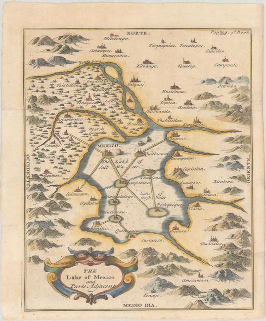
B. The Lake of Mexico and Parts Adjacent, by Antonio de Solis, from The History of the Conquest of Mexico by the Spaniards, circa 1738 (6.4 x 7.8"). This strongly engraved map depicts Mexico City at the center of a lake. The lake (which has both salt and fresh water) is spanned by several roads interconnecting other cities as well. The map locates Pichquique, Quitlavaca, Culiacau, and several others. The map extends to the nearby vicinity to show lakes and mountains and name several other small cities or villages including Talquaj, Cittatepec, Tescatepec, Ottomba, Tepetastac, Curtaleco, and several others. A face is incorporated into the decorative title cartouche. "Page 350. 3d Book." From Thomas Townsend's English translation of Don Antonio de Solis's work.
References:
Condition: A
Crisp impressions on sheets with light marginal toning at the very edges.


