Subject: Belize & Honduras
Period: 1766 (circa)
Publication:
Color: Black & White
Size:
41.2 x 28.6 inches
104.6 x 72.6 cm
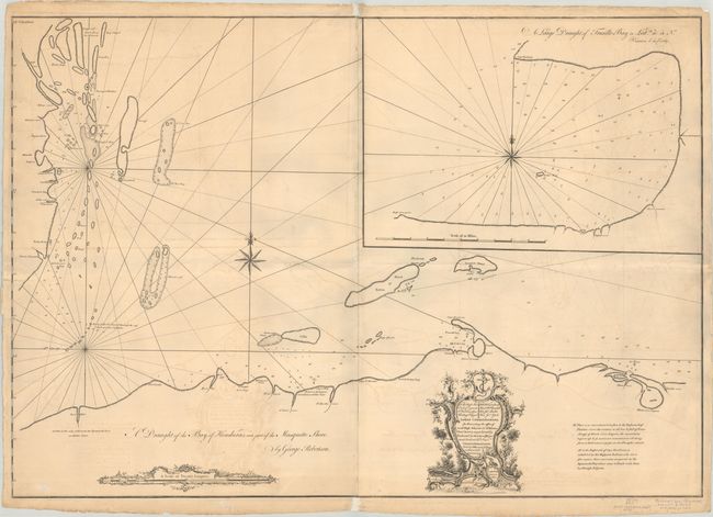
This rare large sea chart by George Robertson covers the Central American coast from the mouth of the Baleeze River (Belize) east to Black River Lagoon (Laguna Ebano). The chart shows the cays in Belize, the Bay Islands (including Roatan), and Glover's Reef. There is good navigational detail throughout, including soundings, anchorages, hazards, and shoals. English text describes the landscape, notes the only Spanish settlement on the coast in the vicinity of Puerto Cortes/Puerto de Caballos, and identifies the land of the Miskito people, "who are a free nation that never was conquered by the Spaniards." A large inset at top right provides an in-depth look at Truxillo Bay. The elaborate dedicatory cartouche at bottom commemorates the Lords Commissioners of the British Admiralty. Sold by Mount & Page. Engraver Larken is credited in cartouche. This is a very rare chart - we found only a few institutional copies and one example on the market from 1966! Printed on two sheets, joined as issued.
References: Kapp (MCC-106) #55.
Condition: B
A nice impression on two sturdy sheets, joined as issued, with light offsetting and minor toning. There are archival repairs to some edge tears, including one that enters 1.5" into map image at left, and to a couple short separations along the joint. There is extraneous creasing resulting from a horizontal fold, resulting in some grayish shadows that are caused by our scanner and do not appear on the map itself.


