Subject: Guadeloupe
Period: 1759-81 (published)
Publication:
Color: Hand Color
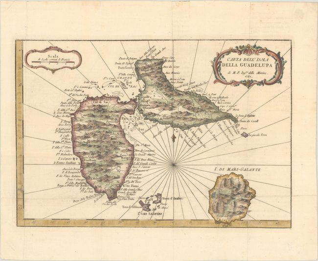
A. Carta dell' Isola della Guadelupa, by Jacques Nicolas Bellin, from Teatro della Guerra Marittima e Terrestre, dated 1781 (11.8 x 8.1"). This handsome map of the island group is adorned with rhumblines, fleur-de-lys, and two decorative rococo-style cartouches. It is filled with good detail and place names throughout. It names La Basse Terre, La Grande Terre, I. di Mari-Galante, Terra d'Abbasso, Terra d'Inalto, and La Piccola Terra. An Italian edition of Bellin's map published in Teatro della Guerra Marittima e Terrestre, which was an atlas to accompany V.A. Formaleoni's Storia delle Rivoluzione dell' America Inglese. Reference: cf. Sellers & Van Ee #2009.Condition: A nice impression issued folding, now flat, on a bright sheet with a "Mezzana" watermark and a hint of offsetting.
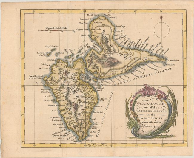
B. Guadaloupe, One of the Caribbee Islands in the West Indies from the Latest Discovery, by Anonymous, from Universal Magazine, published 1759 (8.9 x 7.4"). This small, striking map shows Grande-Terre, Basse-Terre, and several smaller islands. Plenty of place names line the coasts, and there is nice topographical detail inland. An erupting volcano, salt pans, and the "Highlands of St. Ann" are located. The map is decorated with a compass rose and an ornate title cartouche. Published in the March 1759 issue of Universal Magazine. Reference: Jolly #UNIV-76; Sellers & Van Ee #2008. Condition: A crisp impression issued folding, now flat, with minor foxing and faint soiling.
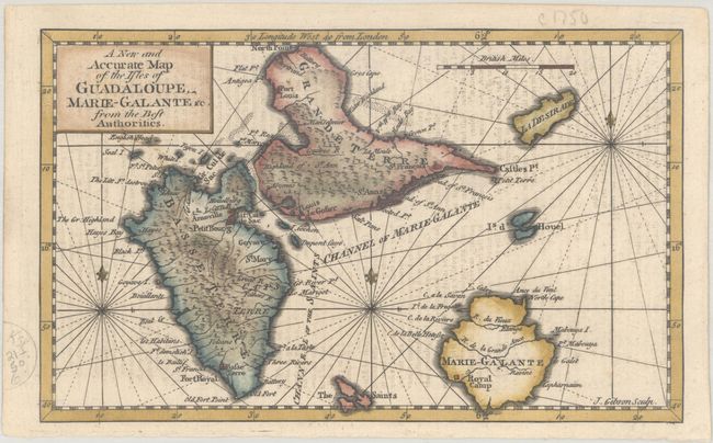
C. A New and Accurate Map of the Isles of Guadaloupe Marie-Galante &c. from the Best Authorities, by John Gibson, from Gentleman's Magazine, published 1759 (7.6 x 4.7"). This small, beautifully engraved copper plate chart details the islands including topography, watershed, coastal features, and settlements. The volcano in the southwest is located. The Saints and La Desirade are shown. The islands are surrounded with rhumblines and three fleur-de-lys. Published in the June 1759 issue of Gentleman's Magazine. Reference: Jolly #GENT-130; Sellers & Van Ee #2014. Condition: A sharp impression with minor offsetting from an opposing page of text.
References:
Condition: A
See description above.


