Subject: Lima, Peru
Period: 1764-69 (circa)
Publication:
Color: Hand Color
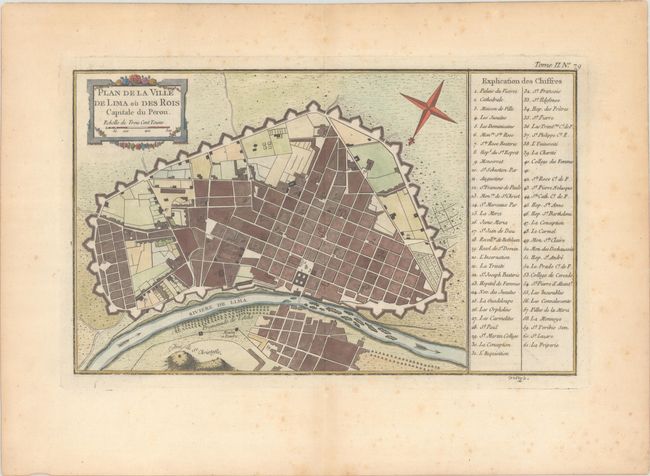
A. Plan de la Ville de Lima ou des Rois Capitale du Perou, by Jacques Nicolas Bellin, from Le Petit Atlas Maritime, circa 1764 (13.7 x 8.3"). This attractive city plan of Lima shows streets and fortifications and a numbered key locates 61 places. The compass rose orients north to the lower left corner. The map was engraved by Croisey. Condition: There is light foxing that is mostly confined to the blank margins and the legend at right, as well as light toning along sheet's edges. (B+)
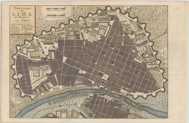
B. Platte Grond van Lima de Hoofstad van Peru, by Isaak Tirion, from Hedendaagsche Historie, of Tegenwoordigestaat van Amerika, circa 1769 (10.3 x 7.3"). This striking plan shows the fortified city of Lima in nice detail. A key below the title identifies the major buildings, including a palace, cathedral, town hall, and hospital. The city is protected on one side by a river while extensive ramparts and suburbs surround the other sides. Tirion's Hedendaagsche Historie was initially conceived as the Dutch edition of Thomas Salmon's Modern History. The work began in 1729, but the text was later expanded and the Hedendaagsche Historie was therefore not completed until 1803. Reference: Shirley (BL Atlases) G.TIR-1a #12. Condition: A sharp impression, issued folding, now flat, with minor offsetting in the right blank margin. (A)
References:
Condition:
See description above.