Catalog Archive
Auction 201, Lot 384

NO RESERVE

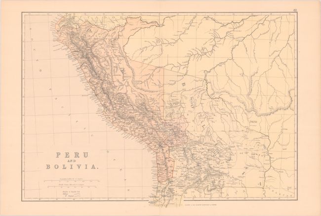
"Peru and Bolivia", Blackie, W. G. & Son
Subject: Peru & Bolivia

Period: 1882 (circa)

Publication: The Comprehensive Atlas & Geography Of The World

Color: Printed Color

Size:
19.8 x 14 inches
50.3 x 35.6 cm
Download High Resolution Image
(or just click on image to launch the Zoom viewer)

This nicely detailed atlas map of the region shows Bolivia with the Pacific region of Cobija that was lost to Chili in the War of Pacific in the 1880s. Conjectural tributaries and a note about the farthest point reached on the Purus River suggest the difficulties colonizers ran into while navigating the rivers of the region. The map indicates railroads both proposed and operational.

References: Rumsey #1589.082.

Condition: A

A couple marginal edge tears, otherwise near fine.

Estimate: $40 - $60

Sold for: $6

Closed on 11/20/2024

Archived