Subject: Southern South America
Period: 1749-99 (circa)
Publication:
Color: Hand Color
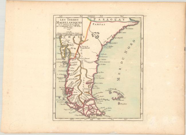
A. Les Terres Magellaniques, by Didier Robert de Vaugondy, from Atlas Portatif Universel et Militaire, dated 1749 (6.4 x 7.5"). This map shows the southern tip of South America from just south of the Rio de la Plata to Tierra del Fuego. The Falkland Islands, here labeled I. Nouvelles peu connues (little known new islands), are only partially delineated. Condition: A crisp impression with full contemporary color on a sheet with a medallion watermark. There is minor foxing and light toning that is mostly confined to the margins.
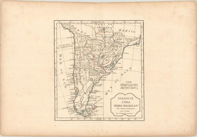
B. Paraguay, Chili, Terre Magellan?, by Robert de Vaugondy/Delamarche, circa 1799 (8.6 x 9.6"). This is the revised and updated Delamarche edition of this map of southern South America. The mythical L. de Los Xarayes appears near the top of the map as the source of the Paraguay River, with several small islands in its waters. The Falklands, here called Isles Malouines, are still depicted as a single island with no defined western coast. A large note identifies the Pampas and the etymology of the name. Condition: A nice impression with contemporary outline color and light dampstaining confined to the ample margins.
References: cf. Pedley #493 & #494.
Condition: A
See description above.


