Catalog Archive
Auction 201, Lot 388

"Carte Reduite de la Partie la Plus Meridionale de l'Amerique, pour Servir a l'Histoire Generale des Voyages", Bellin, Jacques Nicolas
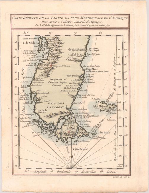
Subject: Southern South America

Period: 1757 (circa)

Publication: Histoire Generale des Voyages...

Color: Hand Color

Size:
6.7 x 9.1 inches
17 x 23.1 cm
Download High Resolution Image
(or just click on image to launch the Zoom viewer)

This finely engraved French map of the region spans from Isla Grande de Chiloe south past Cape Horn. There is excellent coastal detail, including several bays, ports, rivers, and small islands. Active volcanoes are graphically depicted near Purgatoire on the western coast and in Tierra del Fuego. The Maldives are rendered as a large island without a defined western coast. "Tome XI No. 1" at bottom right.

References:

Condition: A

A crisp impression on watermarked paper with a hint of marginal toning.

Estimate: $100 - $130

Unsold

Closed on 11/20/2024

Archived