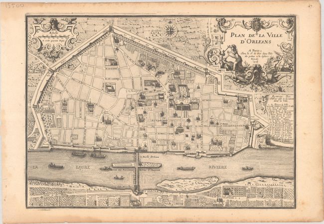
Subject: Orleans, France
Period: 1705 (dated)
Publication: L'Atlas Curieux ou le Monde...
Color: Black & White
Size:
13.4 x 9.6 inches
34 x 24.4 cm
A lovely bird's-eye plan of the city of Orleans and its fortifications along the Loire River. Many streets are named, and a numbered key identifies 30 locations. This example is accompanied by a sheet of French text describing Orleans.
References: Pastoureau, FER I D.
Condition: B+
A crisp impression on a lightly toned sheet with a bunch of grapes watermark and some dampstains and foxing along the edges of the sheet. There are four tiny worm holes at top, only one of which enters the image. The additional sheet of text is also lightly toned with marginal dampstaining and a few tiny worm holes in the top margin.