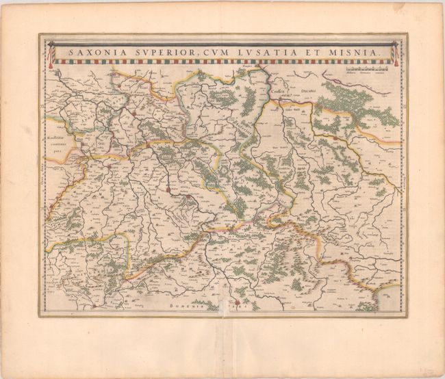
Subject: Eastern Germany
Period: 1642 (circa)
Publication:
Color: Hand Color
Size:
20.1 x 15.5 inches
51.1 x 39.4 cm
This finely engraved and detailed map of the region includes the cities of Halle, Leipzig, Magdeburg, Dresden, and Frankfurt an der Oder, and extends east to Glogow and south to Prague. The map is fully engraved to show the forests and tiny villages and decorated with a long title banner at top. Dutch text on verso, published between 1642-64.
References: Van der Krogt (Vol II) #2100:2A.
Condition: B+
A nice impression with full contemporary color on a bright sheet. There is an old paper repair on the bottom centerfold and an abrasion along the centerfold in the image at bottom.