Subject: Northeastern Germany & Northwestern Poland
Period: 1730 (circa)
Publication:
Color: Hand Color
Size:
23.7 x 18.7 inches
60.2 x 47.5 cm
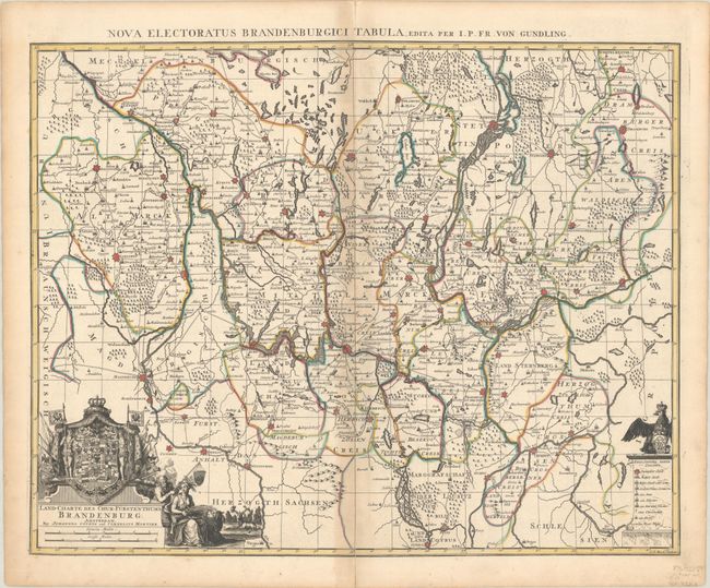
Based on the work of Jacob Paul von Gundling, this was the most accurate map of the region at the time. Von Gundling (1673-1731) was the much-abused court historiographer for King Frederick I and Frederick William I of Prussia and the President of the Prussian Academy of Sciences. As part of his duties, he spearheaded the comprehensive mapping of Prussia and compiled an atlas of Brandenburg. Centered on Berlin, this map includes the walled cities of Salzwedel, Magdeburg, Wittenberg, Krosno Odrzanskie, Drezdenko, Drawsko Pomorskie, and many more. A key at bottom right identifies cities of various sizes, villages, monasteries, postal routes, and more. The ornate title cartouche features allegorical figures and a beautifully rendered Crest of Brandenburg. An alternate Latin title runs above the upper neatline: Nova Electoratus Brandenburgici Tabula. Engraved by G.P. Busch.
References:
Condition: B+
A fine impression with contemporary outline color. There is light toning and minor offsetting along the centerfold, as well as short centerfold separations in the top and bottom blank margins.