Catalog Archive
Auction 201, Lot 55
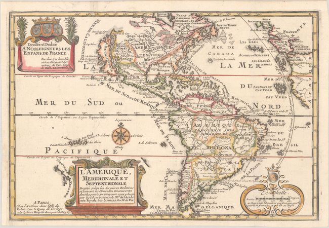
"L'Amerique, Meridionale et Septentrionale Dressee Selon les Dernieres Relations et Suivant les Nouvelles Decouvertes dont les Points Principaux sont Placez sur les Observations...", Fer, Nicolas de

Subject: Western Hemisphere - America
Period: 1717 (dated)
Publication: L'Atlas Curieux ou le Monde...
Color: Hand Color
Size:
13.1 x 8.9 inches
33.3 x 22.6 cm
Download High Resolution Image
(or just click on image to launch the Zoom viewer)
(or just click on image to launch the Zoom viewer)

