Subject: Ukraine
Period: 1639 (circa)
Publication: Nouveau Theatre du Monde
Color: Hand Color
Size:
15.9 x 12.4 inches
40.4 x 31.5 cm
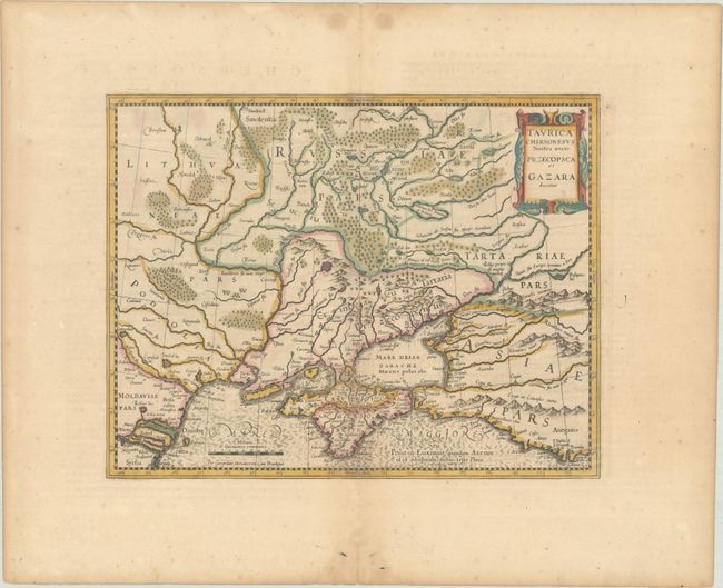
Mercator's fine map of the region north of the Black Sea encompasses the Crimea and the southern steppes of Ukraine. This map served as the basis of most other cartographer's depictions of the region throughout the seventeenth century. The interior is filled with large forests and mountains with little information on settlements except along the rivers. This is the second state, with an updated title cartouche. French text on verso, published between 1639-44.
References: Van der Krogt (Vol. I) #1890:1A.2; Vavrichin et al, p. 140-41.
Condition: A
A nice impression with full contemporary color, minor offsetting, and a hint of toning. There are dampstains and light foxing confined to the edges of the sheet, and a short centerfold separation at bottom.


