Subject: Black Sea
Period: 1740 (circa)
Publication:
Color: Hand Color
Size:
22.2 x 14.6 inches
56.4 x 37.1 cm
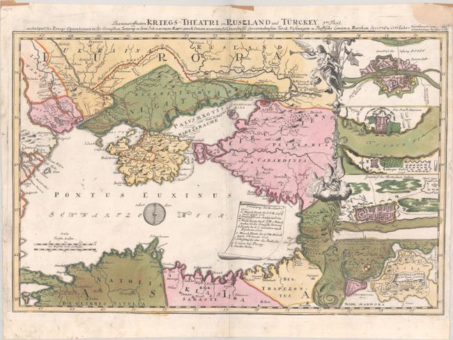
This rare map was published by Adam Jonathan Felssecker in Nuremberg and depicts the Russo-Turkish theater of war around the Black Sea in 1736-37. The locations of Russian and Turkish fortifications and troops are shown, including a long line of Russian fortifications extending across the Ukraine. An engraved sheet of parchment in the Black Sea contains a lettered key to identify various marches made by the troops. At right are four inset maps: three of which depict forts at Azov, Oczocou (Okzokov) at the mouth of the Dnieper River, and Bender, Moldova along the Dniester River; the fourth inset shows the important Bosphorus Strait and the city of Constantinople.
We've only found one other example of this map for sale in the last 30 years, and a handful of examples in institutions.
References:
Condition: A
A crisp impression with full contemporary color on a bright sheet with small remnants of paper tape along the top edge of the sheet. There is a chip at top right that has been repaired with small loss of the publisher imprint.


