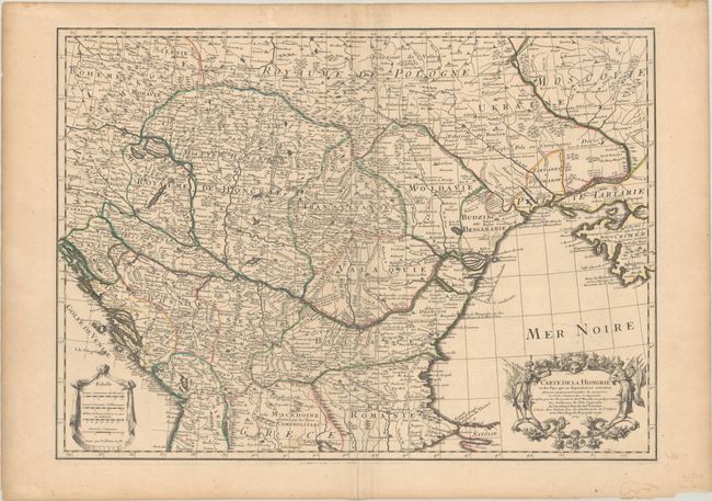
Subject: Southeastern Europe
Period: 1703 (dated)
Publication:
Color: Hand Color
Size:
25.8 x 18.5 inches
65.5 x 47 cm
This handsome map covers the region between the Gulf of Venice and Croatia to the Black Sea in good detail and includes Bulgaria, Romania, Macedonia, Ukraine, Hungary, plus part of Poland and Bohemia. This was the first map depicting the Danube bend and the river fairly accurately. It has a very decorative title cartouche with figures, flags, and weapons, and the scale of miles is shown on a drape-style cartouche.
References:
Condition: B+
A crisp impression with contemporary outline color on a sturdy sheet with a large watermark of a Maltese cross encircled in rosary beads. There is light soiling, some extraneous creasing along the centerfold, and a couple of tiny rust stains.