Subject: Balkans, Hungary & Romania
Period: 1759-95 (circa)
Publication:
Color: Hand Color
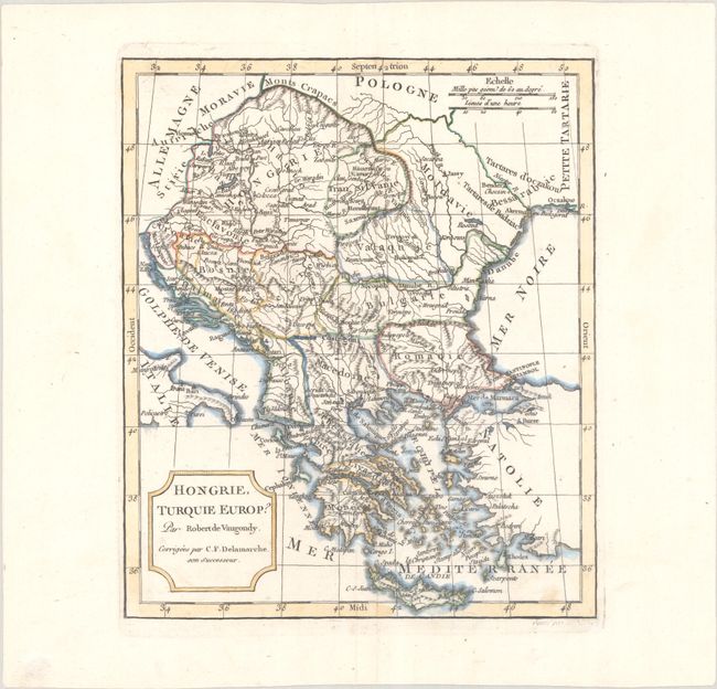
A. Hongrie, Turquie Europ?, by Robert de Vaugondy/Delamarche, from Nouvel Atlas Portatif..., circa 1795 (8.1 x 9.6"). Delamarche's corrected edition of Didier de Vaugondy's map of the Balkans extends north to include Hungary, Romania, and Moldavia, and south to Greece and Crete. The map is filled with information on political boundaries, river systems, and key cities. Reference: cf. Pedley #368. Condition: A nice impression on a bright sheet with a couple tiny abrasions near bottom.
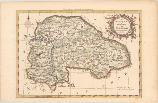
B. An Accurate Map of Hungary and Transilvania: Drawn from the Best Authorities, by John Barrow, from New Geographical Dictionary, circa 1759 (11.2 x 7.8"). This handsome map spans from the Carpathian Mountains south to Belgrade, and from Vienna east to Cronstat (Brasov). The Danube is prominently shown flowing through the region, and there is excellent topographical detail. Engraved by George Rollos. Reference: McCorkle (18th C. Geography Books) #13 Vol. II [3]. Condition: There is a small wormhole in an unengraved area at bottom left that has been infilled with archival materials, and marginal toning.
References:
Condition: A
See description above.