Subject: Western Balkans
Period: 1644 (circa)
Publication: Theatrum Orbis Terrarum
Color: Hand Color
Size:
19.8 x 15.1 inches
50.3 x 38.4 cm
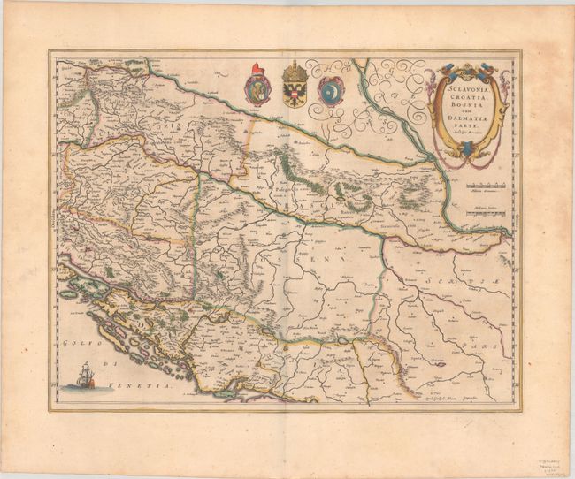
The course of the Danube and its tributaries across the northwestern Balkans is the focus of this handsome map. It shows the political divisions of Slovenia, Croatia, Bosnia, Serbia and Dalmatia and locates even the tiniest hamlets. The title is enclosed in a strapwork title cartouche that credits the map to Gerard Mercator. The coats of arms of the Venetian Republic, Habsburg Monarchy, and Ottoman Empire reflect the power struggle that dominated this region. Latin text on verso, published between 1644-55.
References: Van der Krogt (Vol. II) #7601:2A.
Condition: B+
A nice impression with full contemporary color on a sheet with a large "VC" watermark, one small rust spot at bottom left, and light foxing. There is a printer's crease at top right just outside of the image.