Catalog Archive
Auction 201, Lot 58

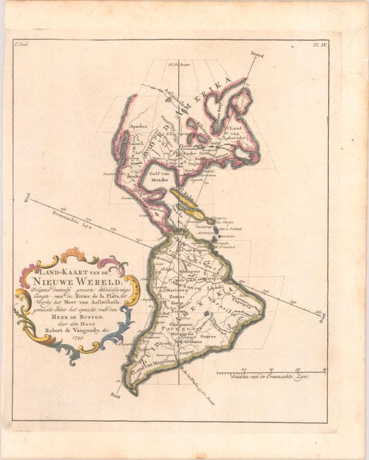
"Land-Kaart van de Nieuwe Wereld, Volgens Deszelfs Grooste Middellynige Langte van de Rivier de la Plata, tot Voorby het Meer van Assiniboils...", Robert de Vaugondy, Didier
Subject: Western Hemisphere - America

Period: 1749 (dated)

Publication:

Color: Hand Color

Size:
7 x 8.4 inches
17.8 x 21.3 cm
Download High Resolution Image
(or just click on image to launch the Zoom viewer)

This is a rare Dutch edition of this interesting map showing the north-south and east-west axes at oblique angles to the continents. In North America, the Pacific Northwest coastline is not delineated and a series of rivers and lakes make up a Northwest Passage. At upper right, inside the neatline is "Pl. IV." The French edition of this map, engraved by Guillaume Delahaye, is given a full-page illustration in Pedley's book on page 94 and is discussed in her chapter "Maps that Illustrate and Teach."

References: cf. Pedley #18.

Condition: A

A crisp impression with marginal foxing.

Estimate: $120 - $150

Sold for: $90

Closed on 11/20/2024

Archived