Subject: Central Italy & Corsica
Period: 1592 (published)
Publication: Theatrum Orbis Terrarum
Color: Hand Color
Size:
19.1 x 12.9 inches
48.5 x 32.8 cm
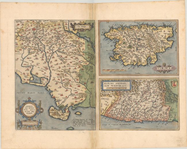
Folio sheet with three separate maps. At left is a map of part of the Tuscan region in Italy with Sienna near the top, based on the work of Cesare Orlandi in 1573. At top right is the island of Corsica, based on the work of Agostino Giustiniani in 1567, and below that is the Ancona region along the coast of the Adriatic, based on an anonymous map from 1564 published by Vincenzo Luchini. Each map is adorned with decorative cartouches. Latin text on verso, published in 1592.
References: Van den Broecke #137.
Condition: B+
A sharp impression with full contemporary color on a sheet with the crossed arrows watermark commonly found on Ortelius maps. There is light toning along the centerfold along with professional repairs to some short separations and small holes along the centerfold.