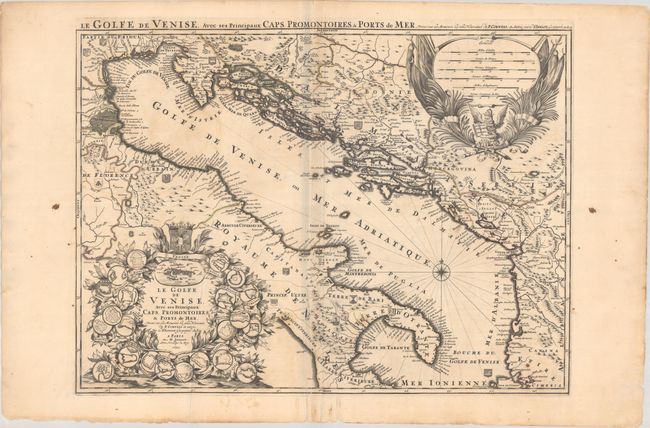
Subject: Eastern Italy & Dalmatian Coast
Period: 1693 (dated)
Publication:
Color: Hand Color
Size:
28.2 x 21.5 inches
71.6 x 54.6 cm
This beautiful large map of the Gulf of Venice and the Adriatic Sea illustrates the theater of the Ottoman-Venetian Wars. The map covers the eastern coast of Italy and follows the coastline of the Adriatic to the Balkan states. The region was contested between the Ottoman Empire and the Republic of Venice in seven major conflicts from the 15th through the early 18th centuries. Political divisions are delineated, with the coat of arms displayed for each region. There is an impressive title cartouche at lower left that features the plans for 22 different coastal fortifications surrounding a scene of Venice and topped by the Hapsburg coat of arms. At top right is a large cartouche with six different distance scales above a winged and crowned lion with the Gospel representing the Republic of Venice. The map is based on the cartography of Coronelli and Sanson, with the overall map design clearly indebted to Coronelli's Golfo di Venezia, Descritto... (1688).
References:
Condition: B
A dark impression with contemporary outline color and a couple cracks from oxidation of green pigment, now backed with archival materials along with the rest of the areas with green pigment to prevent further cracking. There is minor toning, a few small ink stains, extraneous creasing around the centerfold, and a small wormhole by the border at right. There are some minor chips and tears along the edges of the sheet.


