Subject: Western Hemisphere - America
Period: 1787 (circa)
Publication: Geographie Moderne
Color: Hand Color
Size:
21.8 x 12.4 inches
55.4 x 31.5 cm
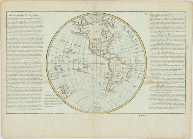
This is the second state of Clouet's map of the Western Hemisphere, and features a very unusual depiction of Alaska, which was updated for this edition. Alaska appears to have three bulbous peninsulas, each separated by a large "canal." A note beside the Krenitzin Islands indicates that they were described by a Russian, Peter Kuzmich Krenitzin, in 1768. Most of North America remains blank in the interior, with the exception of a few rivers. The nomenclature Lac de Fonte appears in northern Canada, which had been delineated in the first state of the map and served as a Northwest Passage, but was eliminated in this state. New Zealand is shown in a very rudimentary form, and further south the Terres Antarctiqes are labeled but also no longer delineated. The tracks of Bougainville and Cook are shown in the oceans, and the Sandwich Islands are shown as where Capt. Cook was killed. Flanked by panels of French text, which are included in the total measurement.
References:
Condition: B
Contemporary outline color on a slightly bluish sheet with the watermarks of a bunch of grapes and "Fin de A [heart] Vimel Duchampt 1786." There is light toning along the centerfold and edges of the sheet, as well as some stains mostly confined to the text around the map.


