Subject: Jerusalem, Holy Land
Period: 1695 (circa)
Publication: An Atlas Containing ye Best Maps of the Severall Parts of the World...
Color: Black & White
Size:
18.1 x 12.1 inches
46 x 30.7 cm
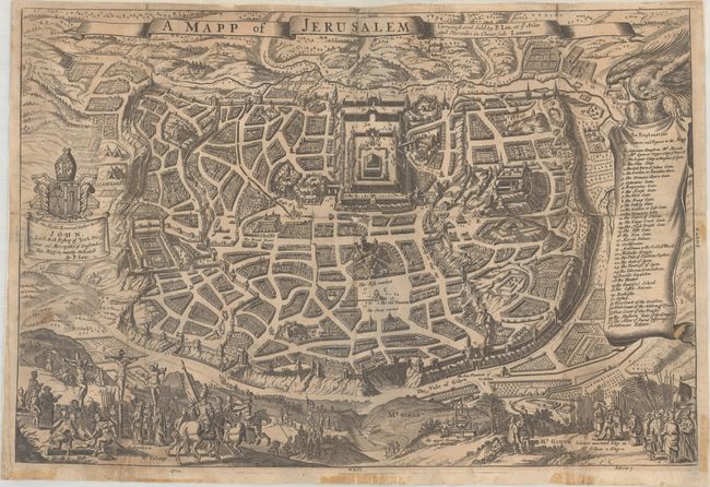
This rare bird's-eye plan is an adaptation of an earlier view by Joseph Moxon. While it is imaginary, it provides great detail of the city walls and streets, with 36 principal sites numbered and keyed to a table in scroll at right. In the foreground are illustrations of the crucifixion and Solomon being anointed as King of Israel. The map is further decorated by a dedication cartouche at left and a banner title cartouche at top. This map is not listed in Laor, and we found no past sales records in the last 30 years.
References: Shirley (BL Atlases) T.LEA-1a #30.
Condition: B
Issued folding and now flattened and backed with heavy tissue to reinforce and repair several small fold separations with minor loss at the center junction. There is some light soiling and old tape stains along the sheet edges from a previous framing.


