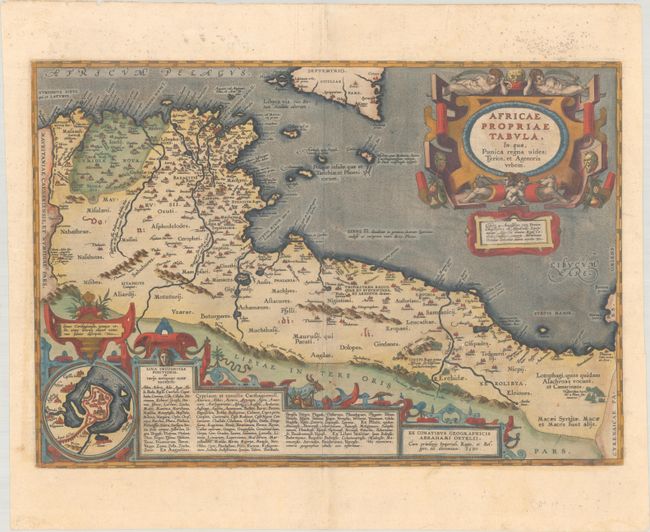
Subject: Northern Africa
Period: 1590 (dated)
Publication: Theatrum Orbis Terrarum
Color: Hand Color
Size:
19.2 x 13.2 inches
48.8 x 33.5 cm
Very decorative map of the coastline covering present-day Tunisia and Libya based on Gastaldi's great map of Africa and the ancient texts of Diodorus, Siculus, Plinius, Virgilius, Appianus, Halicarnasseus, Athenaeus, and Herodotus. The map extends to include Sicily and Malta. It includes a fabulous strapwork title cartouche and a large cartouche at bottom containing text and an inset plan of Carthage. This is the first state with Latin text on verso, published in 1595.
References: Van den Broecke #218.
Condition: B+
Full contemporary color with the crossed arrows watermark commonly found on Ortelius maps. There is light color offsetting at bottom, a few minor abrasions, and a single wormhole along the middle centerfold. Minor staining is confined to the top blank margin.


