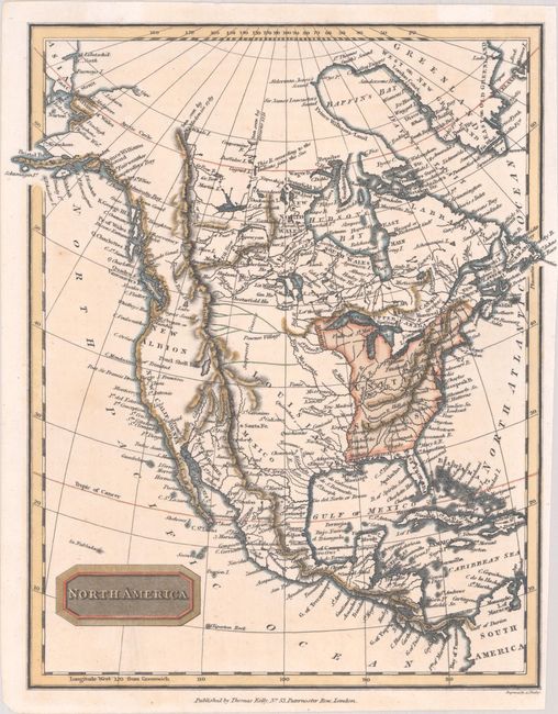
Subject: North America
Period: 1812 (circa)
Publication:
Color: Hand Color
Size:
8.1 x 9.8 inches
20.6 x 24.9 cm
This attractive map of North America shows the United States confined to east of the Mississippi River, Louisiana stretching from the Mississippi River west to the Rocky Mountains, and Spain in control of the western United States. The map is pre-Lewis & Clark with several "Supposed Courses" of the Missouri River up to the Stony Mountains. Alaska is taking shape with a few islands shown along the Aleutian Peninsula. In northern Canada, the discoveries of MacKenzie and Hearne are noted along with a river "according to the Indians joins the Sea." Engraved by Alexander Findlay.
References:
Condition: A
On a clean bright sheet of paper with an "1812" watermark.


