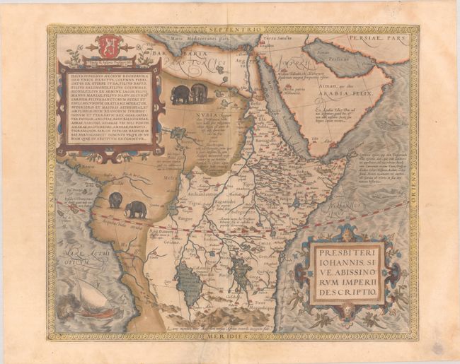
Subject: Central Africa
Period: 1579 (published)
Publication: Theatrum Orbis Terrarum
Color: Hand Color
Size:
17.4 x 14.8 inches
44.2 x 37.6 cm
This great map depicts the central African kingdom of Prester John, the mythical Christian priest-king who, according to legend, provided a bulwark against Barbarians and was an ally to the Crusaders. Ortelius designed this map himself using geographical information including Gastaldi's 1564 map of Africa. The mythical twin lakes of Zaire and Zaflan are shown as the origin of the Nile, with the Mountains of the Moon located as the source of the lakes. Two pairs of large elephants appear in the interior, and sea monsters and an Arabic ship (dhow) are depicted in the Atlantic. Two large strapwork cartouches balance the sheet, one enclosing the title and the other with text of the legend. The dedication is to King David, with a long genealogy tracing Prester John's lineage back to that of the Biblical king. Latin text on verso.
References: Norwich #11; Van den Broecke #175.
Condition: B+
A nice impression with full contemporary color on a lightly toned sheet with the crossed arrows watermark commonly found on Ortelius maps. There is marginal soiling and a vertical crease to the left of the centerfold that has been pressed flat and archivally reinforced on verso.


