Subject: Pacific Ocean
Period: 1810 (dated)
Publication:
Color: Black & White
Size:
27.1 x 19.5 inches
68.8 x 49.5 cm
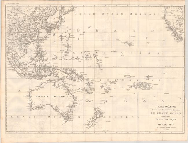
This terrific French map of the Pacific extends from Tibet to western North America, with fantastic detail of the various island groups in the Pacific. Australia is Nouvelle Hollande with Bass Strait named and French names for Spencer Gulf (G. Bonaparte) and St. Vincent Gulf (G. Josephine) in Terre Napoleon. North of Honshu Island in Japan is Matmay Chicha ou Jeso with a conjectural western coastline and I. des Etats and I de la Compagnie to the northeast. The eastern tip of Papua New Guinea is left open-ended. The Sandwich Islands (Hawaii) are well-mapped. In North America, a speculative Branche Meridionale connects Lac de Timpanagos to the Columbia River and the Pacific. Engraved by C.B. Glot.
References:
Condition: B+
A nice impression, issued folding on a bright sheet with a "B [heart] F" watermark, light offsetting, and a couple of small rust spots. The right margin is narrow due to a binding trim, and an associated binding tear that enters 2" into the image has been closed on verso with archival tape.


