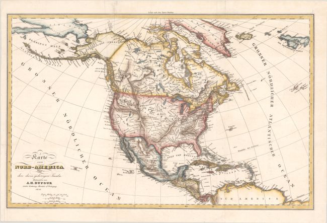
Subject: North America
Period: 1836 (dated)
Publication:
Color: Hand Color
Size:
19.8 x 12.6 inches
50.3 x 32 cm
This finely engraved German map extends from the Aleutian Chain to the Caribbean. It is filled with information on rivers, lakes, and mountain ranges, and also includes numerous place names. Texas is named and Mexico controls the Southwest. The West coast is divided between Neu Albion and Neu Californien, and Alaska is named Russisches America. The contemporary myth of an east-west running mountain range west of the Rockies is present, as are Lake Timpangogos and several conjectural rivers flowing through the Great Basin.
References:
Condition: A
A sharp impression issued folding, now pressed, with a binding trim in the bottom left margin that has been replaced with old paper to better accomodate framing. There are archival paper repairs in the top blank margin and a couple minor extraneous creases.


